
Features Colorado Springs Trails
Colorado Springs, Colorado has an abundance of interesting places to hike and bike.
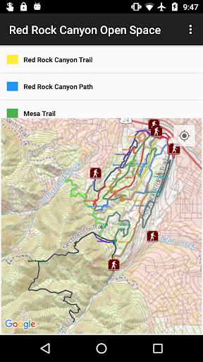
This app catalogs over 200 trails in and around Colorado Springs, divided into 18 areas including Garden of the Gods, Palmer Park, Red Rock Canyon Open Space, North Cheyenne Canyon, Manitou Springs, and different sides of Pikes Peak.
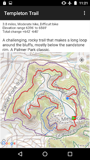
Included are accurate tracks for over 330 miles of trails, 65 trailheads, and 80 complete hikes (routes).
Distance and elevation change are provided for each trail and route, along with a short description and a difficulty rating.
A "Favorites" list gives you a set of interesting hikes to try, sorted into different categories (easy, hard, waterfalls, etc.)Maps are in four formats (USGS National Map Topo and three Google Map variations), with USGS Topo maps built into the app for offline use.
All maps (area, trail, route) include your current position, very useful when navigating in the field in an unfamiliar area.
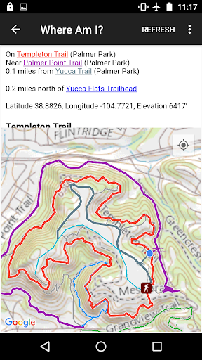
The "Where Am I" feature will tell you which trails you are on or near, and the distance to the nearest trailhead.
Food & Dining
Discover recipes and order food from your favorite restaurants.
Offline Mode
Use the app without an internet connection. Your data syncs when you're back online.
See the Colorado Springs Trails in Action
Get the App Today
Available for Android 8.0 and above